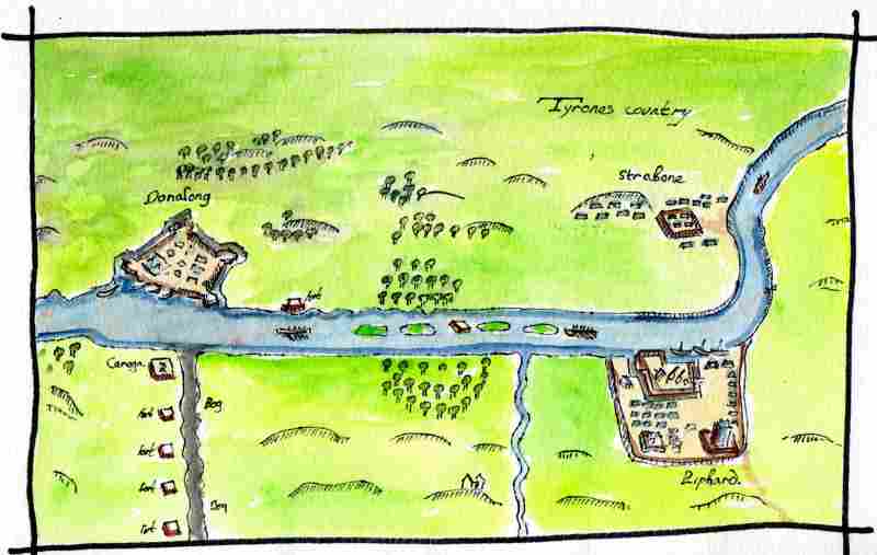
Part of this defensive activity in the Sixteenth Century may have been a reaction to increased English interest in the Strabane area. Henry VIII declared himself King of Ireland in 1560 and by 1595 O’Neill and O’Donnell were in open rebellion against his daughter Elizabeth I. This is a copy of the first map drawn of the area with some colour added. It was drawn in 1600 to record the fortifications erected by the English along the Foyle during what became known as the Nine Years War. O’Neill had demolished his tower house in Strabane by this time but O’Donnell’s tower in Lifford can be seen.


 RSS Feed
