|
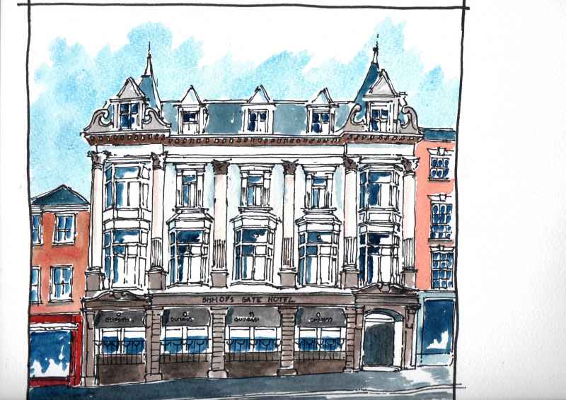
Around the corner on Bishop Street is the former Northern Counties Club remodelled in 1902 by the same architect Alfred Forman. Full of spikes and bays this was a gentleman's club until the early 2000's. After a long period of vacancy it was bought by the Inner City Trust and remodelled as a boutique hotel. which opened in 2016. The works retained the Edwardian grandeur of the interior, with its magnificent staircase, inglenook fire place and fine function rooms on the first floor overlooking the street.
0 Comments
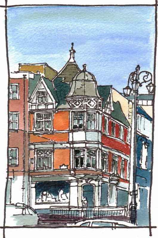
On the other side of the Diamond, a smaller building from the same period is worth a look. This is Diamond Chambers (1899) another confident piece of architecture. it was designed by Alfred Foreman who was responsible for a number of fine buildings in the city during the following ten years.
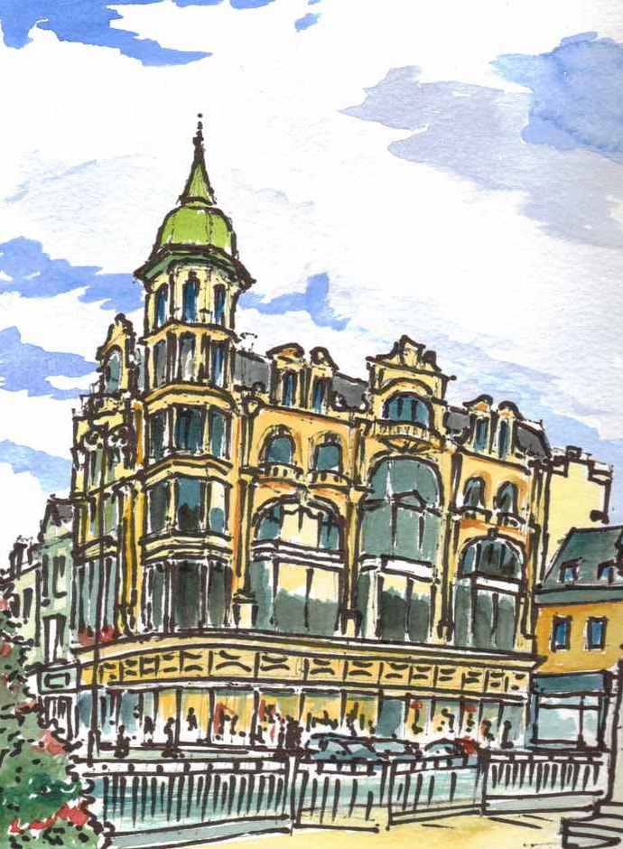
Dominating the Diamond today is the Austin's building. Unfortunately vacant for a number of years, following the demise of a company that prided itself in being the 'worlds oldest department store'. Austins is a great, confident building, full of bays, columns, and swagger. Inside, it has a double height space on the ground floor and a fine, if slightly tilted, staircase. The building was designed by Matthew A Robinson at the height of the city's economic boom in the early years of the Twentieth Century and replaced an earlier department store on the same spot. In December 2022 the Council passed a motion to set up a taskforce to encourage a new use for this important building. Unlocking a new future will not only preserve a historic building, but will add life and activity to the Diamond and enhance the atmosphere of the city centre.
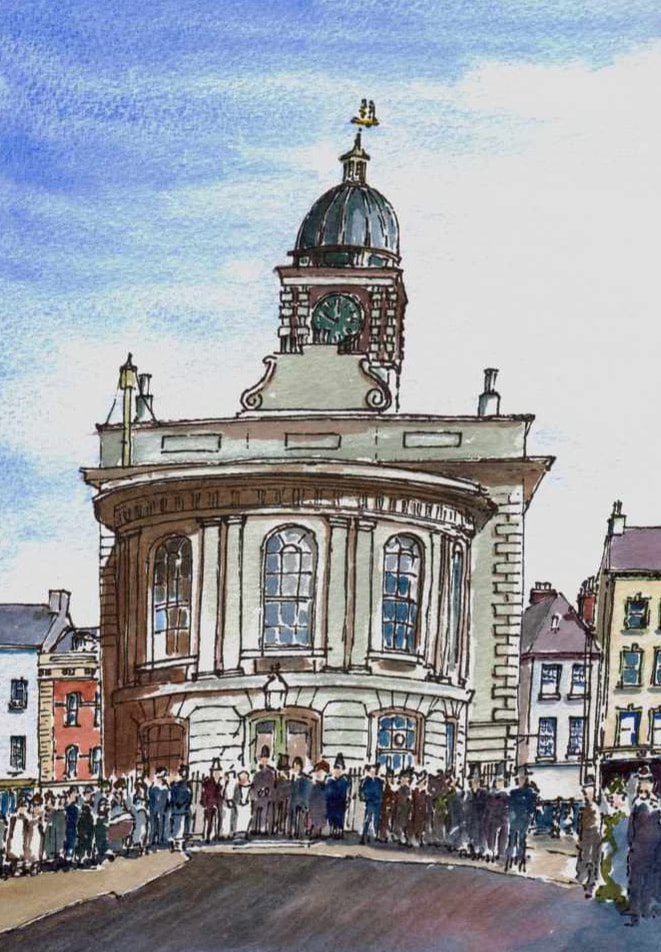
The market house the centre of the Diamond was destroyed in the Great Siege of 1689 and rebuilt with money donated by William and Mary in thanks for the 108 day defence of the city against King James which had been important in securing their throne. Like many market houses across Ulster it was arcaded at the base with a meeting/ court room over. Over time the arcades were filled in and in the 1830's the building was significantly rebuilt, remodelled and extended to function as the Corporation Hall hall. In the 1890's this function moved to the new Guildhall and the building became an art college. This suffered a fire in 1903 and was repaired but it was demolished and replaced with a civic garden in 1910. A war memorial was added in 1928. The cellars of the Corporation Hall remain under the surface. This image is based upon a photo of c.1890.
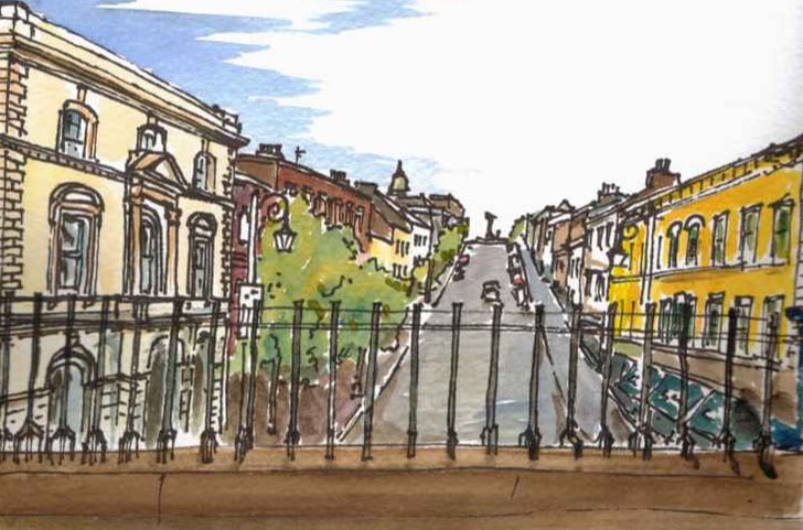
Go up onto the monument along the steps beside Magazine Gate and walk along the top to Shipquay Gate. Looking over the railings here gives you the best understanding of the historic town. You can see the Main Street - Shipquay Street - rising up to the town square or Diamond at the top. The street is very steep for a commercial space, and reflects the need to enclose both the high ground of the former island that the city is built upon and its access to the river.
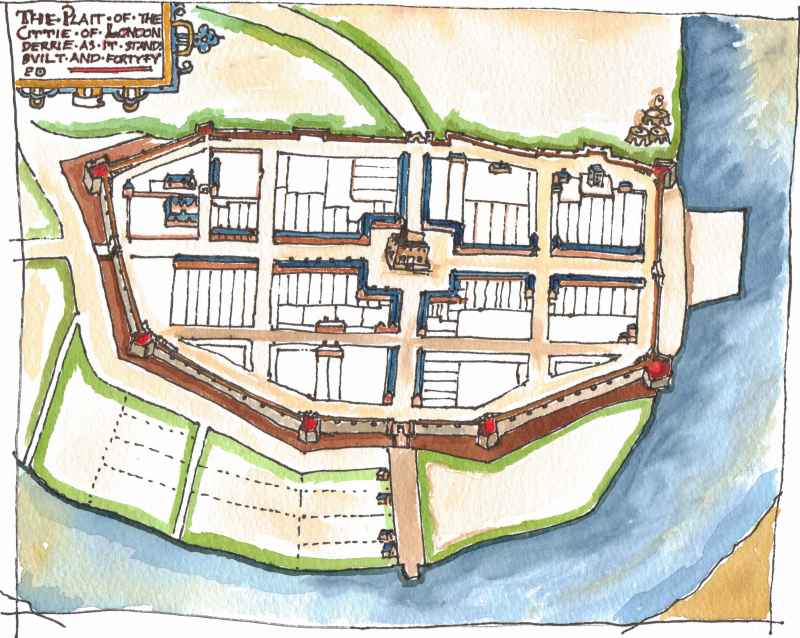
To get your bearings and to understand the layout of the Walled city, you should look at this map, which is a copy of one drawn in 1623. This shows the regular layout of the city. A main street rising from the Ship Quay to a central square caries on to a gate at the western end of the city. A bisecting street from the square connects to gates to the north and south. To the north, overlooking the current Bogside, and at the time the marshy remains of a former river channel ,the defences are fairly straight and there is no sign of a moat. this is because along this stretch, they followed the natural contours which were scarped or cut back to make them more defensive. On the southern side where the slope is gentler, there is more of a curve to the walls and a moat is indicated. The walls have regular bastions that project out to provide flanking fire. The whole thing is based on the latest technology of the time. The defences are low and thick, to give maximum protection against cannon balls. The other thing to note is that this is a post medieval city. It is a colony of the merchants of the City of London. A church or a king's residence are not the focus of the plan. The market square is. This is the start of the modern secular era. At the time the 'garrison church' was a fixed up medieval church in the north west corner of the plan. 10 years later a cathedral was, however, built. This is located at the south west corner and, actually, was on the highest part of the city - so the church may be to one side but it still holds significant power.
Magazine gate has a parabolic arch i.e it forms a parabola which allows it to be wider than it is high. This is Victorian construction and reveals the fact that it was a new opening of 1865 to increase flow through the monument at that time. Its keystones never-the-less represent two hero's of the Great Siege of 1689 - Cairns and Murray.
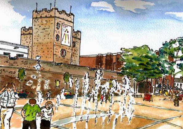
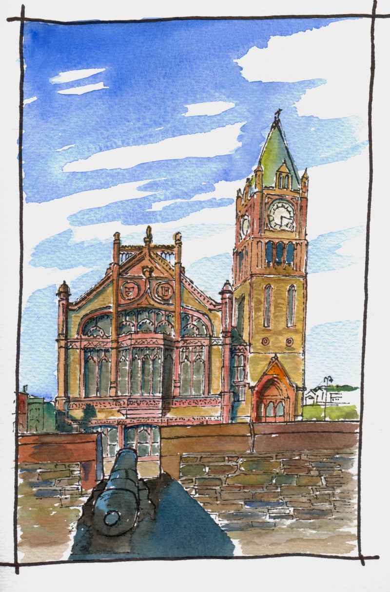
Opposite the Guildhall are the City Walls. These were built between 1613 and 1618 and once bordered on the river or 'Ship Quay'. The walls are earthen with a stone facing over a metre thick and the original construction is below the string course. The monument was raised along this section in the nineteenth century to increase its impressiveness.
Walk across to Magazine Gate in the distance. Now, to the city centre. Shipquay Place, more commonly referred to as Guildhall Square. Look up at the Guildhall and at the crests high up above the windows. On one side the arms of the city and on the other, the arms of The Honourable the Irish Society. Those of the city have a skeleton sitting beside a castle, supposedly a reference to a Norman knight staved to death at Nortbburg Castle further up the Foyle in 1333. These are understood to be the pre- Plantation coat of arms. Above, are the arms of London affixed in 1613 when the city was rebuilt and became the principal settlement of the City of London in the Ulster Plantation.
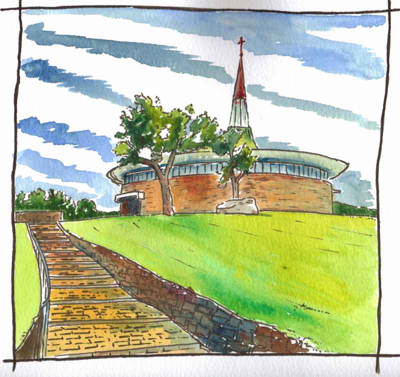
The company which managed the plantation In the newly created county and oversaw the rebuilding of Derry, now Londonderry, and Coleraine. was the Honourable the Irish Society. Their coat of arms also incorporates the arms of the City of London and on the other half has the 'red had of Ulster'. This denotes the province in heraldry, but is also the symbol of the O'Neill's until the Plantation heads of the Cenel Eoghan and chieftains of this area. The Guildhall was originally constructed in 1887 in the sparse Venetian Gothic style popular at that time, but it suffered a devastating fire in 1912 and was rebuilt in a much more ornate style of gothic with many references in its architecture and windows to the history of the city. Much of the money for its construction came from the Irish Society and from the 12 London Guilds that had carried out the plantation in the county. Hence the name given to the building. It is well worth the visit to see the interior and this is open to the public along with a free exhibition on the events that led up to the Plantation. At the bottom of the hill, Burt Chapel. Clearly inspired by the form of Grianan, it is a very subtle piece of design and well worth the visit. It was designed by Liam McCormick and opened in 1967. Filled with specially commissioned art its circular interior does not align with the exterior providing space for a sacristy behind the altar. It was voted Irish building of the 20th century in a public poll in 1999.
|
Marks of Time
Sketches of buildings in the North West of Ireland and further afield with a little information about their history. Categories
All
Archives
June 2024
|

 RSS Feed
