|
A monument in State Care near the southern end of the Ards Peninsula. Today, an oval of standing stones overlooking a quiet bay, but in 1953, the scene of a significant archaeological investigation. The small sandy mound, enclosed by the stones, was excavated by Dudley Waterman, Principal Inspector of the Archaeological Survey of the Department of Finance. He found a complicated sequence of structures below: a pre existing wall; a long stone cist with the remains of 15 individuals; a further cist outside this surrounded by a shingle bank; then, seven more small cists containing cremations. Many of the stones found were decorated with curvilinear and rectilinear motifs. It turned out to be a very rare and fascinating monument with lots to teach us about our past.
0 Comments
The former market house of Newtownards, the largest of the type in Ulster looks out upon a specially designed square and fills one side. As with all of these buildings, the ground floor was originally open and used as a market. In 1835 this was potatoes and grain on the eastern side and meat on the western side. The building was completed in 1771 and its cupola ( bell tower) was added in 1778. The first floor has meeting rooms and a grand central room sits over the main arch with fine plasterwork. This was used as a function room and later as the council chamber. It is an elegant building.
Founded in 1244 as a Dominican (Black Friars) abbey. Extensively remodelled in the 14th century. Suppressed in 1541 and burnt in 1572. Refurbished as a church after the Plantation following transfer of ownership from in 1605 from Con O'Neill to Hugh Montgomery of Ayrshire. Quickly converted to a dwelling house with grand gardens to the west along what is now Court Street. The tower was added in 1632. its fine Jacobean door case at the base of the tower, with the arms of the Montgomery's, is likely to date from this time. The house was destroyed in a fire in 1664 and the building appears to have reverted to a church once again.. it was sold in 1675 to the Colville's of Galgorm and then in 1744 to the Alexander's of Mount Stewart. Between 1833 and 1850 it was used as a courthouse after which it again became roofless. The gardens remained in 1832 but were gone, replaced by a terrace, by 1846. Today, it is a fascinating ruin with its tower (which once had a stone spire) centred on the north side of the building and emphasised by the walk towards it from the nearby park. its windows to the street are high and give a defensive air. Inside, there are four high Gothic arches on circular columns separating the north aisle from the main nave. In the south wall are some blocked up openings which once led to the cloister beyond. A place that has seen a lot of history and repays a visit.
Old Market Cross Newtownards. Thought to date from 1636, this structure originally had a door and a stair to a platform from which public pronouncements were made. At the centre was a high stone pillar with a lion on top. It is not clear when this was replaced by the current stone roof. and weather vane. The original design has Scottish precedents The structure's base is now much lower than road level.
Reputed to have been founded in 540 by St Finnian, Movilla Abbey was once the focus of an extensive monastic city of some renown. Plundered by the vikings in 840, it never fully recovered and was attached to Bangor Abbey in 910 and, like most of the ancient monastic sites on the island at that time adopted the Agustinian rule. With the arrival of the Anglo Normans from 1177, the church appears to have been rebuilt to serve a new settlement around it - Nove Ville de Blathewyc. Extended again in the 15th century, it was suppressed in Henry Vlll's dissolution of the monasteries in 1542 and since used as a graveyard. A much destroyed ruin survives but this is reasonably large for a medieval site reflecting both the influence of the Normans and the power of the monetary at the time of its dissolution. The east gable survives with a three lancet window with simple interlocking tracery above (sometimes described as First Pointed gothic). This was blocked at some stage to be replaced by a simple slit window in the centre. Along north beside the nearby road, an entrance has been blocked and medieval grave slabs, until recently built into the inner side of the wall have been removed for safe keeping. The west gable has a single arched window. Now colonised by graves, there is a particularly fine nineteenth century mausoleum built in the form of a church in the same Winstone schist as the historic church but with sandstone details and a fine decorative iron screen. Hard to get to across the overgrown graveyard, but worth the visit. You can also appreciate the siting of the original foundation on high ground overlooking Strangford Lough still visible in the distance below..
Constructed in 1857 to commemorate the 3rd Marquis of Londonderry, who lived in Mount Stewart House, Scrabo Tower is a six story tower in a French influenced Scottish Baronial style situated on top of a hill overlooking Newtownards and the Ards Peninsula. A Monument in State Care, maintained by the Historic Environment Division of the Department for Communities, it was erected inside a Bronze Age hill fort and is visible for miles around.
Ballycopeland windmill, near Millisle in Co Down, is a rare survivor of a once more numerous type. Thought to have been constructed around 1785, it remained in use until 1915. it was gifted by its owners to the State in 1935 and has remained in its care ever since. It was comprehensively restored in 1978 and again between 2015 ad 2017 and is now in full working order. It is the only windmill to remain in the world with this type of sail. The team who restored it received a Heritage Angels award in 2017 and you can see a video of their work here: heritageangelawards-ni.org.uk/award-year/2017/
Not indicated on the 1957 OS Map, Millisle lagoon is a man made breakwater that floods twice a day and captures the retreating tide to form a good place for watersports and swimming in this small seaside village.
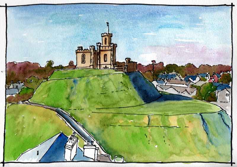
Dominating the costal town of Donaghadee is the well preserved earthworks of an Anglo Norman motte and bailey castle. These are surmounted by an early nineteenth century sham fort. It is a large structure defending one of the shortest crossings between Ireland and Scotland. The fort was built to house gunpowder for the building of the nearby harbour in 1821. Restored in 2021, it currently houses a camera obscura. the Norman family most associated with the motte were the De Coupland's who also gave their name to the Copeland Islands located about a mile offshore.
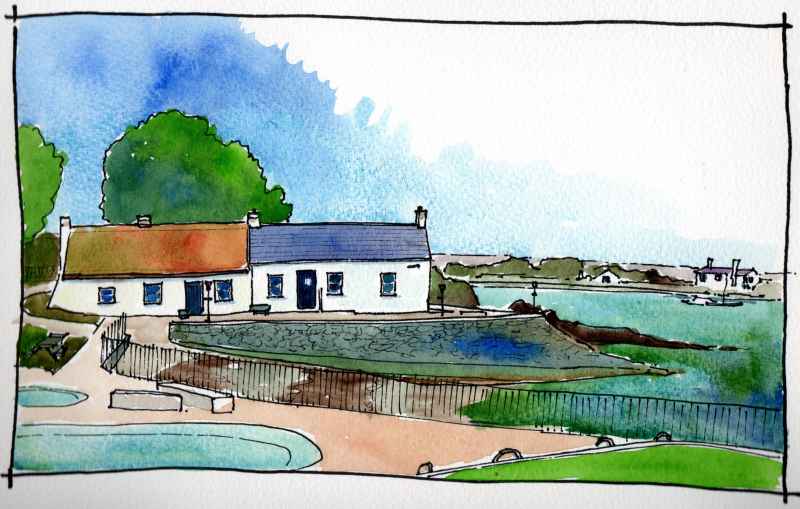
Cockle Row, Groomsport. Two fine fisherman's cottages at the edge of the harbour in Groomsport. One retains its thatched roof. Dating from at least the early nineteenth century, they may be much older. Rescued from demolition in the 1950's by the local art club, they bring strong character and add to the attractiveness of this small village, Both are open for the summer period and worth a spot if you are in the vacinity.
|
Marks of Time
Sketches of buildings in the North West of Ireland and further afield with a little information about their history. Categories
All
Archives
June 2024
|


 RSS Feed
