
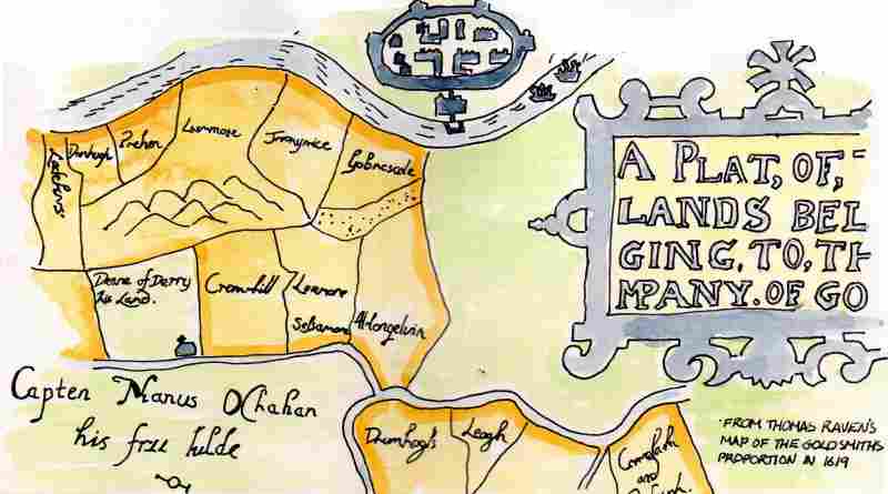
This map, of what is now much of the Waterside area of the city and pointing west at the top, is a copy of one drawn in 1619 just after the Ulster Plantation. It shows the medieval church of Clondermott, appropriately, on land owned by the church. Altnagelvin townland and those to the south and east are indicated as owned by the Goldsmith’s Company. This London Company was one of 12 who received ‘proportions’ in the new county of 'Londonderry’ from the King in the Plantation. This was in response for substantial funds and came with conditions such as the requirement to build a 'bawn' on every proportion of 1000 acres and that 10 British families had to be settled on each area of this size. The Goldsmiths bawn was in New Buildings to the south of this map. Some Gaelic lords received/ retained lands in the new arrangement such as Captain Manus O'Cahan. He is indicated on this map owning the area to the east and south of the River Faughan and its tributary the Burngibbagh, ( now Tullyalley and Ardmore). To the west at the top of the map can be seen the River Foyle and the new walled city of 'Londonderry’.
 RSS Feed
