
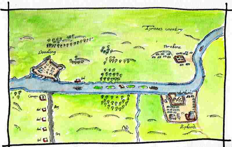
Further south along the river is Dunnalong. This has been translated as the ‘fort of the ships’ and was the location of a tower house in late medieval times. This drawing is a copy, with colour added, of the first map of the area from 1601. This shows the fortifications erected at the site by the English during the Nine Year’s War. It can be seen that the settlement was nearly as big as Lifford further up stream at the time and much bigger than Strabane. After the war its importance declined and at present there is very little to see at the site. Only the faint outline of the ditches and a few fragments of the tower house remain. There was a detailed archaeological investigation in 2012.
