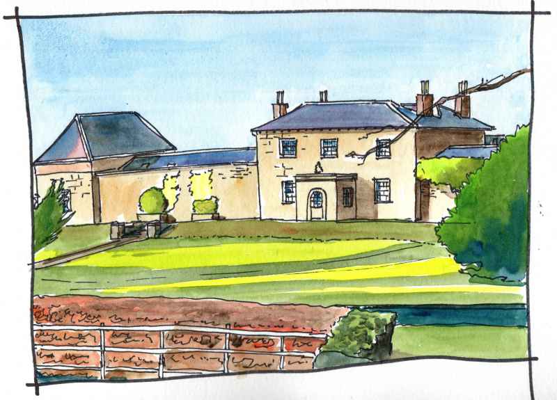
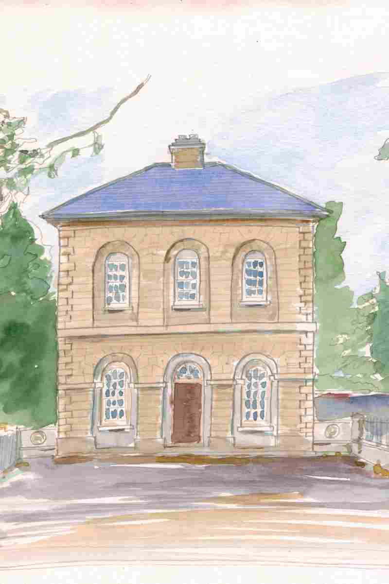
At the next roundabout turn right to what is sign posted as the ‘plantation village of Eglinton’. This is dominated by its former courthouse, standing opposite the access road to the village which is now used as a credit union. This was built in the 1820’s and held a petty sessions court on the first floor and a market space among open arcades on the ground floor with a medical dispensary to the rear. The buildings real use, however, was an important architectural set piece at the heart of the village signifying the taste and sophistication of the Grocer’s Company of London. Though they had been granted the surrounding area by King James I in the Seventeenth Century, as part of the Ulster Plantation, they had leased the land to agents until the lease came up again upon the death of George III in 1820. They, like many of the other London Companies with lands in the county, then took direct control and a period of architectural competion ensued with direct investment in villages like Eglinton, Ballykelly, Draperstown, Moneymore, and Kilrea. As part of the plan, in this village, two complementary buildings were built on either side of this focus. The Manor House to the left remains in fine condition. The Glen House to the right has unfortunately been heavily renovated, following a period of use as a hotel, and has lost much of its character. The court house has been recently well conserved and is well worth a visit. On the wall to one side is the arms of the Grocer’s Company who gave up their involvement with the village following the land reforms of the 1890′s.
At the far end of the village is a remnant from plantation times. This is the surviving gable of its original church dating from 1826. On the opposite side of the road under the peresent rectory was the ‘castle’. This was beseiged in 1641 and its ruins demolished in the renovation and enhancement of the village by the Grocers Company in the 1820′s. The current parish church behind was another symtom of this change it was funded by the company and constructed in 1821.
Back to Clooney Road, City of Derry Airport is located beside the road on another former WWII airfield. This was RAF Eglinton air base home to No. 133 Squadron RAF from 1941 which flew Hurricane fighters. In 1943 the airfield became a Fleet Air Arm base called RNAS Eglinton and was home to the No. 1847 Fleet Air Arm Squadron providing convoy cover as part of the Battle of the Atlantic. In 1978 the airfied was purchased by the district council and the current terminal was erected as part of a significant investment with European Regional Development support and opened in 1993. Designed by WRD and RT Taggart architects it is a bright welcoming building designed for ease of internal adaptability and extension. While significant extensions have not been required the subdivision of the internal space has undergone a number of changes during subsequent years. An open an airy interior has largely been retained however.
Some remnants of the WWII airfield remain, such as this ‘blister’ type aircraft hangar, one of a group of three to the north west side of the airfield. It and the airfield were constructed by the Royal Engineers over the winter of 1940-41.The type had standardised prefabricated components and it was designed to be quickly erected and dismantled. This example, however, has now lasted in the one place for 77 years.
Faughanvale Old Chuch is sited above the road near the village of Greysteel. Hidden from view near a bend in a steep road it is in a very picuresque location with fine views over Lough Foyle. Reputedly the site of a 7th century monastery associated with St Canice..
Carrickhugh Flour Mill sits below Clooney Road with fine views accross Lough Foyle. Today it is a big empty shed used for farm machinery but at one time it was a thriving mill located at the base of a stream to get water power. However, the Ordnance Survey Memoirs of 1830-35 explained that ‘As the supply of water is not good in dry weather, the deficiency has been remedied by a steam engine of 12 horse-power which commenced working a few days since.’ This explains the chimney. The mill continued in operation for various uses until after the Second World War, (when it was used for corn grinding). It was converted to farm use after 1948. Today it is an important and visible reminder of the many former mills in this area, which were once a significant source of employment.
On to the village of Ballykelly. This is also an Ulster Plantation settlement. This was created as the principal settlement of the Fishmongers Company’s ‘proportion’. The original 1610 settlement was closer to Lough Foyle than the present main street of the village (which is part of Clooney Road) and located perpendicular. It stretched south on either side of the river from this church which is now beyond the edge of the village. Most Church of Ireland Churches in the Plantation reused the medieval church building but this was a new construction. It was destroyed two times in the wars of the seventeenth century and abandoned in 1795 when a new church was built closer to the present village. This building has always been known as ‘the Garrison Church’ and was dedicated to St Peter. Its main architectural feature is its curved chancel arch which is thought to date from the time of its earliest construction.
Tamlaght Finlagan Parish Church is situated beside Clooney Road at the northern end of Ballykelly Village. It was finished in 1795 and replaced the former chuch at the end of the Plantation settlement. It was funded by the Earl Bishop- Fredrick Agustus Hervey, and by the local undertaker of the Fishmongers Company lands in the area -John Beresford. The architect is thought to have been Michael Shanahan. He was a Cork architect who had entered the service of the Bishop when he had been Bishop of Cork and who had accompained him on his second ‘Grand Tour’ of the Continent recording classical architecture between 1770 and 1772. The building is a deliberate set piece, set back and parallel to the road with crisp detailing and an elegant form
Closer to main street is Walworth House. This early eighteenth century house is at the end of the original settlement and built into the wall of its seventeenth century defensive ‘bawn’ (a fortified house with a stone wall enclosing a courtyard). This was built by the Fishmonger’s Company as part of their requirements in the Plantation of Ulster, Three flankers (short circular towers with conical roofs) survive at the remaining corners of the wall. The great age of the site is not very aparent in ths view from the nearby road, but the bueatiful charater of the site is. Behind the house is a very well cared for garden which has been opened to visitors at various times in the past
In the field next to to Ballykelly Church is this elegant building. Now a private hospital with modern buildings to the rear, it was built as a model farm by the Fismonger’s Company in 1823 with wings to each side opeing to the farmyard behind and maintaining a formal facade to the road. Like in the nearby village of Eglinton the lease for the ‘proportion’ in which this village is situated reverted to the London company of the Fishmongers on the death of King George III in 1820. They also set about a vigorus campaign to improve and beautify their village in the mid nineteenth century. This was one result.
|
|