
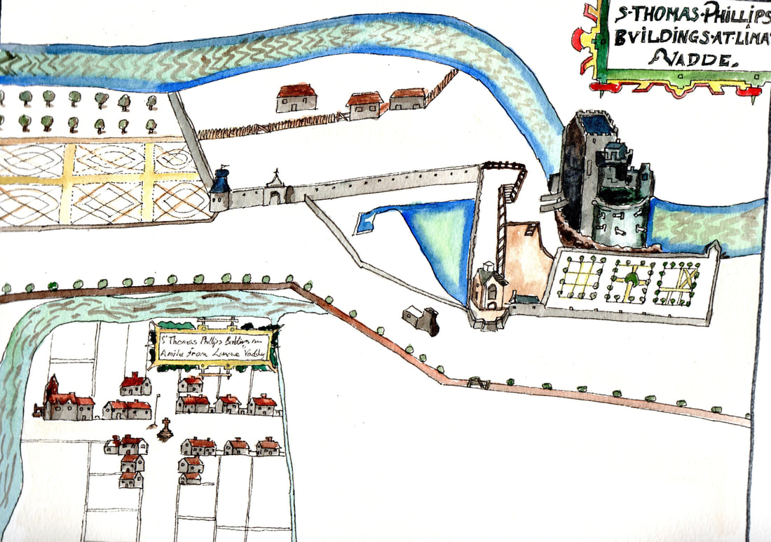
This is a copy of the first map of Limavady from 1622. It was a new Ulster Plantation settlement replacing the former town a mile away around the old O’Cahan Castle within what is now the Roe Valley Country Park. Originally known as Newtown Limavady, the settlement had a cruciform layout with a market cross at the centre and was enclosed on two sides, as today, by the River Roe. The building nearest the river appears to have a projecting sign which has been taken by most comentators to be the representation of an Inn..
