Marks of Time
Historic Buildings as  illustrations of the past.
  • Home
    • City of Culture Exhibition
  • Derry Londonderry
    • The Early City
    • New World Order: The Arrival of the English
    • The Merchant City: The Eighteenth Century
    • The Industrial City: The Nineteenth Century
    • The Troubled City: The Twentieth Century
    • The Creative City: The Twenty-First Century
  • Ulster
    • The Early Region
    • Early Christian
    • Hiberno Romanesque
    • The Anglo Normans
    • Tower Houses and Friaries
    • The Plantation
    • The Georgians
    • Vernacular
    • The Victorians
    • Early Twentieth Century
    • The Twentieth Century
    • The Twenty First Century
  • Strabane
    • The Early Region Strabane
    • Early Christian Strabane
    • Norman Strabane
    • Plantation Strabane
    • A New Order
    • Vernacular Strabane
    • Georgian Strabane
    • The Strabane Canal
    • Arcadian Living Strabane
    • Early Nineteenth Century Strabane
    • Strabane Railway
    • Strabane Industry - Sion Mills
    • Late Nineteenth Century Strabane
    • Early Twentieth Century Strabane
    • Twentieth Century Strabane
    • Twenty First Century Strabane
  • Blog
    • Derry to Strabane
    • Derry to Limavady
    • Kilkenny to Derry
    • Dublin Visit
    • Inishowen Tour
    • Co Down Visit
    • Carrickfergus Tour
    • Stirling
    • Belfast to Derry
  • About
    • Links
    • Further Reading
  • Contact

The Strabane Canal


To further encourage the development of the area, the newly enobled Marquis of Abercorn had an act of Parliament passed to enable the creation of a canal to improve navigation between Strabane and the Foyle in 1790. Construction was complete by 1796. This had the desired effect and the canal was highly profitable until the railways arrived in 1847. The canal ran for 4 miles and had two locks.Crampsie lock  is located at the exit to the Foyle. Devine's Lock is located about a mile upstream.

The canal ended in a ‘basin’ located behind the main streets of the town. This was quickly surrounded by warehousing and became a focus of economic activity.  A plan was developed by architect Robert Woodgate for the area in 1802 and called the ‘New Town’. This image is based upon a photograph taken in the 1890’s.  The basin was filled in in the early 1970’s but features are likely to remain below the present surface. The warehousing to the right of the image still remains and is located behind the Alley Theatre.

Picture
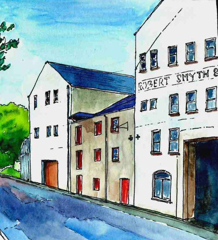
Surviving warehouses, Canal Basin.

Picture
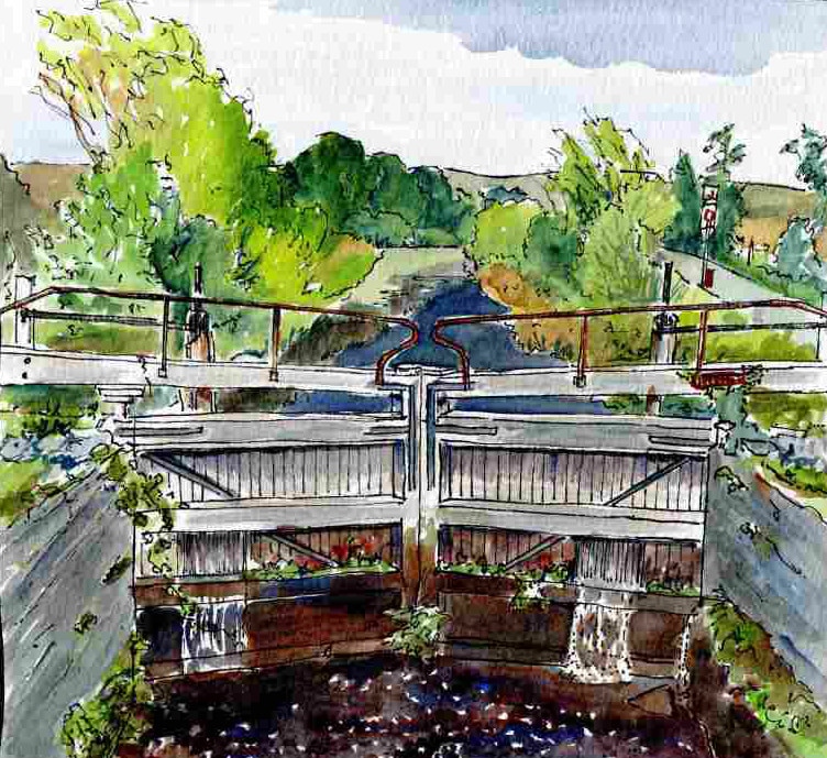
Crampsie Lock, Stabane Canal.
Picture
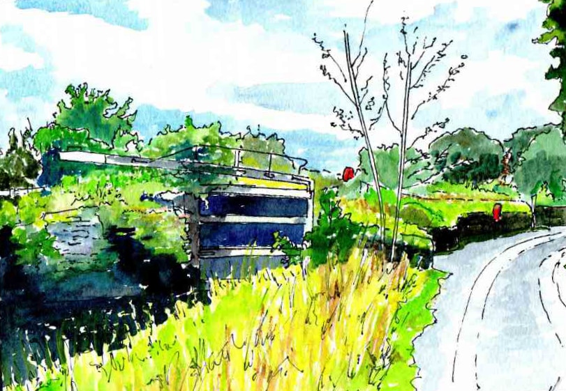
Devine's Lock, Strabane Canal.
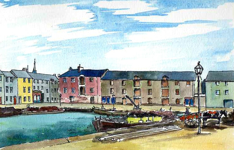
Picture
Canal Basin 1890's
< Back     Arcadian Living>
Powered by Create your own unique website with customizable templates.