Marks of Time
Historic Buildings as  illustrations of the past.
  • Home
    • City of Culture Exhibition
  • Derry Londonderry
    • The Early City
    • New World Order: The Arrival of the English
    • The Merchant City: The Eighteenth Century
    • The Industrial City: The Nineteenth Century
    • The Troubled City: The Twentieth Century
    • The Creative City: The Twenty-First Century
  • Ulster
    • The Early Region
    • Early Christian
    • Hiberno Romanesque
    • The Anglo Normans
    • Tower Houses and Friaries
    • The Plantation
    • The Georgians
    • Vernacular
    • The Victorians
    • Early Twentieth Century
    • The Twentieth Century
    • The Twenty First Century
  • Strabane
    • The Early Region Strabane
    • Early Christian Strabane
    • Norman Strabane
    • Plantation Strabane
    • A New Order
    • Vernacular Strabane
    • Georgian Strabane
    • The Strabane Canal
    • Arcadian Living Strabane
    • Early Nineteenth Century Strabane
    • Strabane Railway
    • Strabane Industry - Sion Mills
    • Late Nineteenth Century Strabane
    • Early Twentieth Century Strabane
    • Twentieth Century Strabane
    • Twenty First Century Strabane
  • Blog
    • Derry to Strabane
    • Derry to Limavady
    • Kilkenny to Derry
    • Dublin Visit
    • Inishowen Tour
    • Co Down Visit
    • Carrickfergus Tour
    • Stirling
    • Belfast to Derry
  • About
    • Links
    • Further Reading
  • Contact

The Derrie


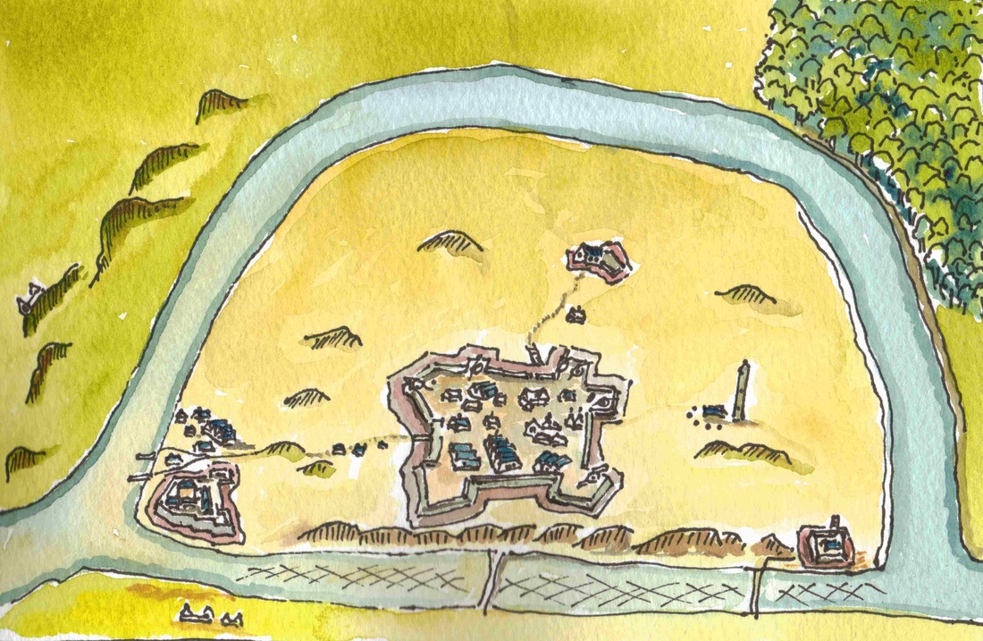
This  is a copy of the first map drawn of Derry with  some colour added.  It was drawn in 1600 to record the fortifications erected on the island by the English during  the Nine Years War. It was one of a number of forts built along the Foyle at  that time as part of an attack on the rear supply base of. O’Neill and  O’Donnell.   The  map shows the tower house built for the O’Donnell’s in the 1550s, some of the  medieval churches, the round tower and the defences of the new  occupiers.

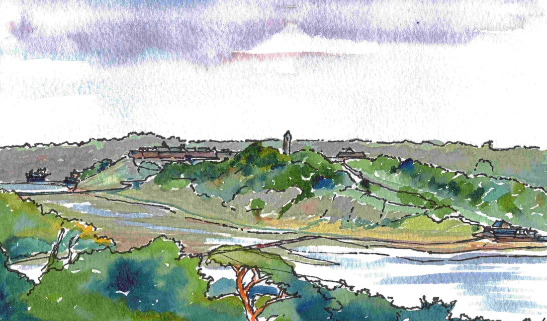
This is a view from  the present  Letterkenny  Road  to the south of the island   of Derry in 1600.  Today’s houses have been  omitted and the buildings indicated on Docra’s map  added. However, because trees are not indicated on the map to the extent they  are shown here, it is  unlikely to be strictly accurate.
 
O’Neill and  O’Donnell’s war ended  in 1604 in defeat at Kinsale.   Though they were re-granted most their  lands by the new King (James I of England and James VI of Scotland)  circumstances had changed and they left for the  Continent in 1607.  Docra had obtained  a royal charter for his settlement at ‘Derrie’ in
1604, but he also left  frustrated in 1606. His successor so antagonised Sir  Cahir O’Doherty of   Inishowen   that he rebelled and  destroyed the town in 1608. The way was left open  for a grand experiment.


Picture
Picture
Picture
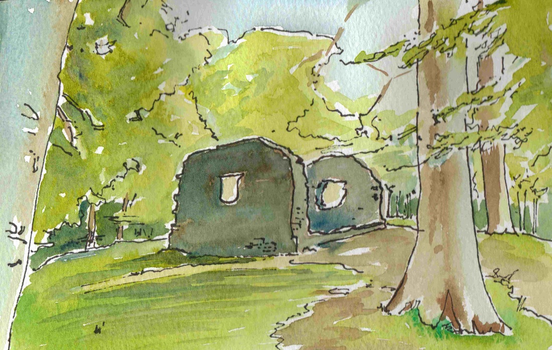
Though rebuilt in the 1620's, St Brecan's church currently  looks much as it appeared on Docra's 1600 map (left side).
< Back            The Plantation >
Powered by Create your own unique website with customizable templates.